5 Great Hikes from Santiago de Compostela, Spain
If the region of Galicia has a counterpart state in the U.S., it would have to be Arkansas, if only for the latter’s state moniker, “The Natural State.” Like Arkansas, Galicia is rugged, forested, and a little hilly, and, in my opinion, it has the most beautiful countryside in Spain. Not only does the region have gorgeous coasts and beaches, it also has simply wonderful interior landscapes.
Living in Santiago de Compostela has given me a chance to get a taste of Galicia’s natural beauty by means of various hiking trails and mountain summits. You can see most of Santiago’s old town in around a day, so if you’re ever passing through here, definitely take some time to leave the city life for the outdoors!
The “Stony Mountain” rears up directly northwest of the old town and is even visible from the central Praza do Obradoiro, just past the Parador hotel. If you’re short on time but looking for that panoramic photo shot, Monte Pedroso is the place to go. Starting from the cathedral, it only takes one hour to hike up the gently sloping hillside, and the summit is wide and spacious, with several radio towers and maintenance buildings to keep you from getting lost. Just beneath the summit is the friendly Parque da Granxa do Xesto, a great place to have a picnic or cookout or even an afternoon coffee before you finish going up to the top.
Monte do Viso is similar to Monte Pedroso, but because it’s on the other side of town to the east, the panoramic views from up top are reversed. It’s fairly difficult to get to—in the middle of nowhere, past family farms, across the highway, and through a forest—so bring your smartphone to not get lost. The “viso” part of the name is a Spanish and Galician word that means “height or elevation, high point or place, which you can see and describe a lot of terrain from.” A lonely and unforgiving summit, yes, but a good place from which to take in the expanse of the modern city of Santiago.
The “Joy Mountain” is called so because in the Middle Ages, when pilgrims made their way west along the Camino de Santiago, Monte do Gozo was the first place they could catch a glimpse of the soaring bell and clock towers of the cathedral: the long-awaited goal they had spent weeks walking toward was finally within reach. Today, it’s kind of a letdown, because tall trees and modern apartment blocks hide the view of the church until you get to Rúa de San Pedro, right outside the old town. Nevertheless, Monte do Gozo is still a highly significant place in Santiago, and from this spot, St. James’ shrine is only an hour away on foot. To get your feet wet in what it means to be a pilgrim, take city bus #6 to the end of the line and hike the final five kilometers back to the cathedral.
“Sacred Peak” isn’t within Santiago’s city limits, but instead in the hamlet of Lestedo 12km southeast on the highway to Ourense. Pico Sacro is a 533m-high mountain with a sharp, conical peak that is unmistakable when viewed from Santiago. It makes a great daytrip and day-hike (uh, one-hour hike); simply take the Monbus to Lestedo and ease up the forested mountainside until you reach the serrated summit, which has some interesting rock formations and even a hidden cave. Don’t head back to Santiago without trying a slice of tarta de Lestedo or local cheesecake!
Another hike I like to recommend to friends is simply heading west from the Praza do Obradoiro and following the yellow arrows and shells pointing to Fisterra, “Lands End” on the west Atlantic Coast. While the Camino de Santiago officially ends at the cathedral, a secondary Camino de Fisterra continues west to the coast to what the ancients believed was finis terræ—the end of the world. Granted, it takes three or four days to get to Fisterra on foot, but the 19km stage to Negreira at the end of the first day is only four hours of walking, and you get to see a beautiful cross-section of Galician eucalyptus forests, rural homes, and pastoral scenes. Just before you get to Negreira, you pass over the Ponte Maceira, an impressive medieval bridge that spans the Tambre River. Several buses head back to Santiago from Negreira daily.
Do you enjoy hiking for fun? Which of these hikes would you most be interested in doing? Cast your vote in the comments below!
Living in Santiago de Compostela has given me a chance to get a taste of Galicia’s natural beauty by means of various hiking trails and mountain summits. You can see most of Santiago’s old town in around a day, so if you’re ever passing through here, definitely take some time to leave the city life for the outdoors!
1) Monte Pedroso
 |
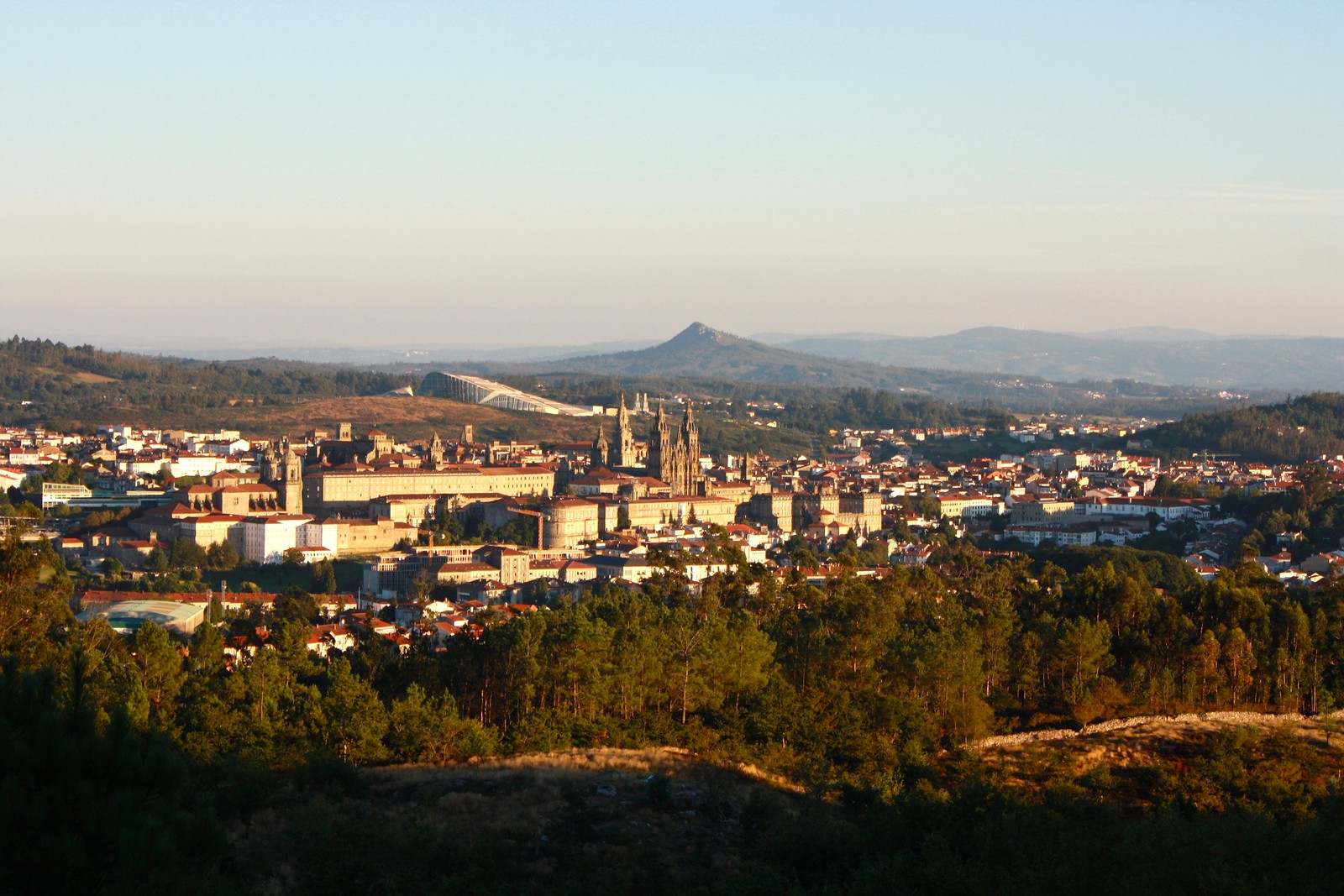
| View of Santiago from Monte Pedroso, Pico Sacro in the distance |
The “Stony Mountain” rears up directly northwest of the old town and is even visible from the central Praza do Obradoiro, just past the Parador hotel. If you’re short on time but looking for that panoramic photo shot, Monte Pedroso is the place to go. Starting from the cathedral, it only takes one hour to hike up the gently sloping hillside, and the summit is wide and spacious, with several radio towers and maintenance buildings to keep you from getting lost. Just beneath the summit is the friendly Parque da Granxa do Xesto, a great place to have a picnic or cookout or even an afternoon coffee before you finish going up to the top.
2) Monte do Viso
 |
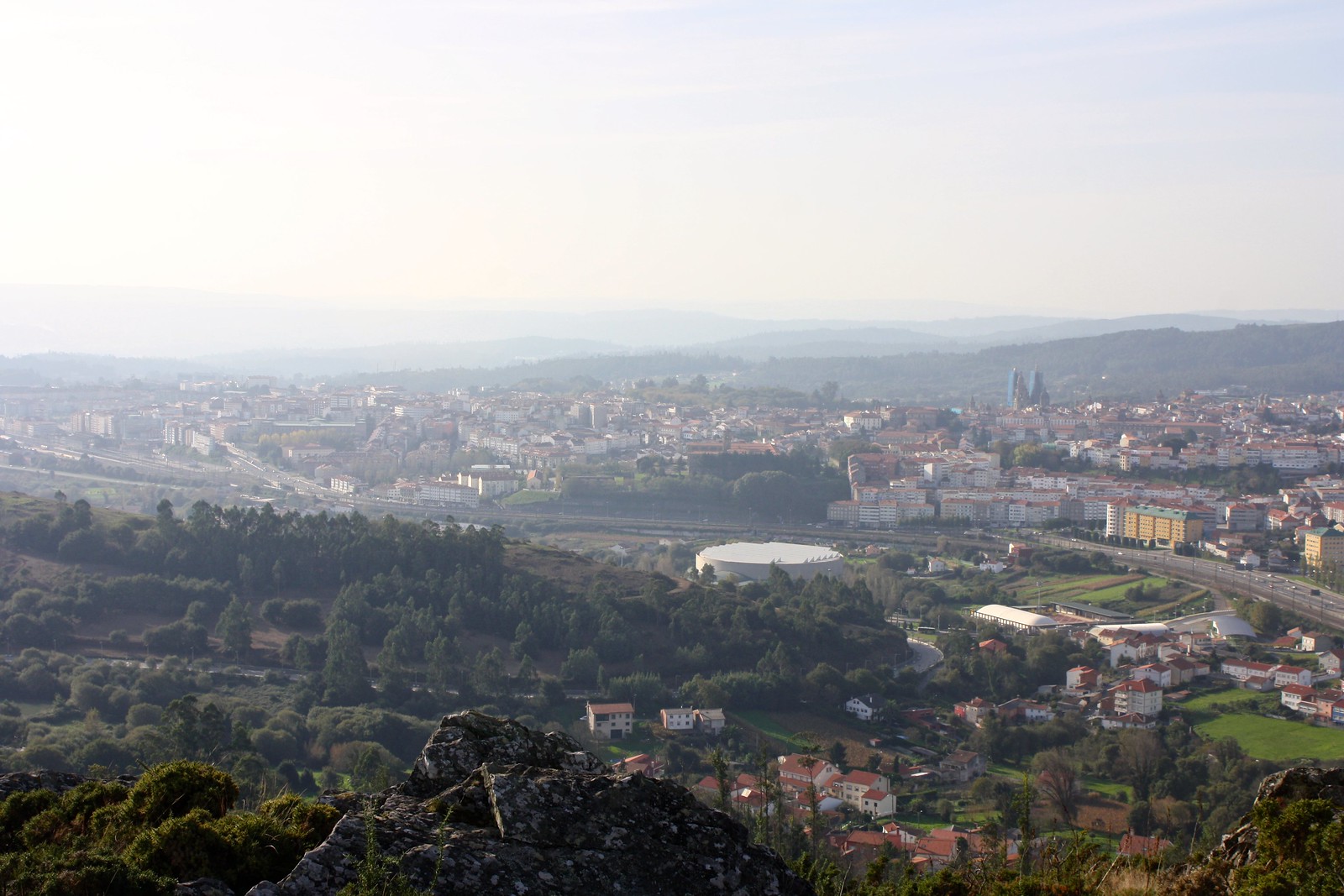
| View of Santiago from Monte do Viso, Monte Pedroso to the right |
Monte do Viso is similar to Monte Pedroso, but because it’s on the other side of town to the east, the panoramic views from up top are reversed. It’s fairly difficult to get to—in the middle of nowhere, past family farms, across the highway, and through a forest—so bring your smartphone to not get lost. The “viso” part of the name is a Spanish and Galician word that means “height or elevation, high point or place, which you can see and describe a lot of terrain from.” A lonely and unforgiving summit, yes, but a good place from which to take in the expanse of the modern city of Santiago.
3) Monte do Gozo
 |
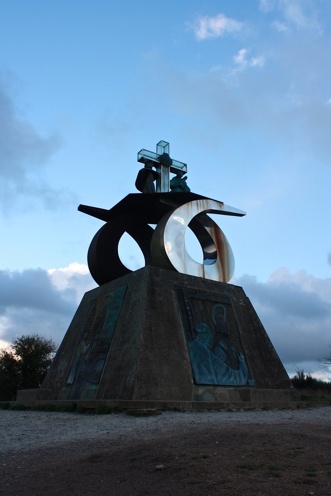
| Monument |
The “Joy Mountain” is called so because in the Middle Ages, when pilgrims made their way west along the Camino de Santiago, Monte do Gozo was the first place they could catch a glimpse of the soaring bell and clock towers of the cathedral: the long-awaited goal they had spent weeks walking toward was finally within reach. Today, it’s kind of a letdown, because tall trees and modern apartment blocks hide the view of the church until you get to Rúa de San Pedro, right outside the old town. Nevertheless, Monte do Gozo is still a highly significant place in Santiago, and from this spot, St. James’ shrine is only an hour away on foot. To get your feet wet in what it means to be a pilgrim, take city bus #6 to the end of the line and hike the final five kilometers back to the cathedral.
4) Pico Sacro
 |
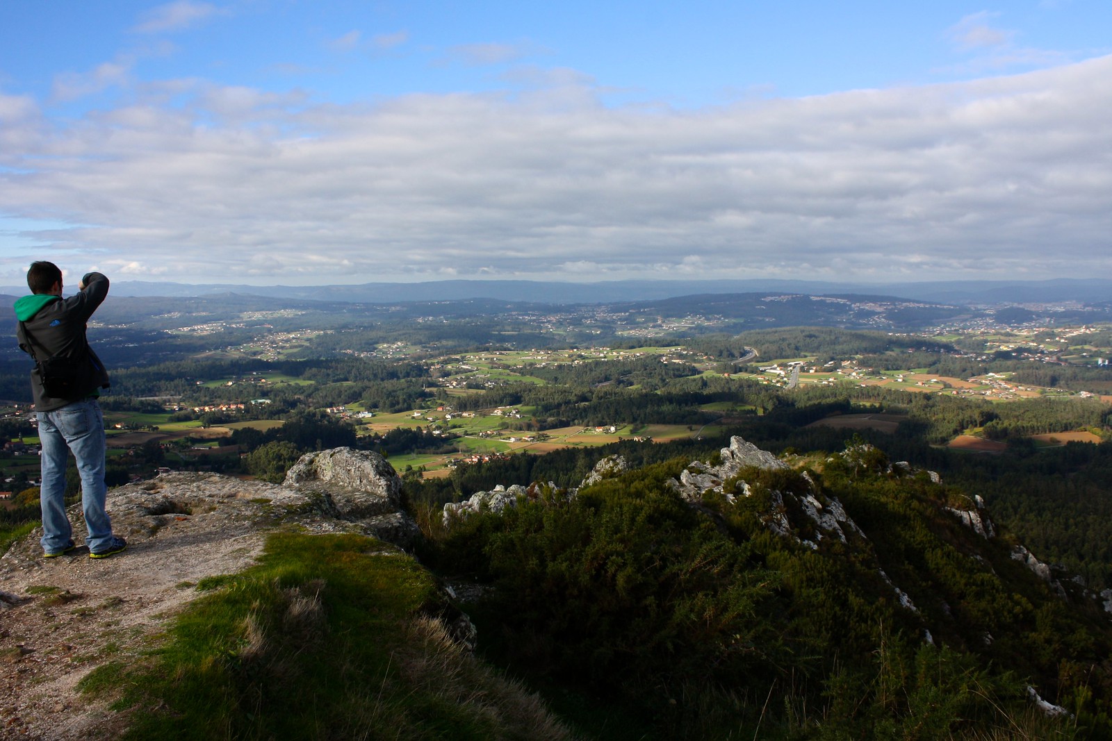
| View from the summit |
“Sacred Peak” isn’t within Santiago’s city limits, but instead in the hamlet of Lestedo 12km southeast on the highway to Ourense. Pico Sacro is a 533m-high mountain with a sharp, conical peak that is unmistakable when viewed from Santiago. It makes a great daytrip and day-hike (uh, one-hour hike); simply take the Monbus to Lestedo and ease up the forested mountainside until you reach the serrated summit, which has some interesting rock formations and even a hidden cave. Don’t head back to Santiago without trying a slice of tarta de Lestedo or local cheesecake!
5) Negreira
Another hike I like to recommend to friends is simply heading west from the Praza do Obradoiro and following the yellow arrows and shells pointing to Fisterra, “Lands End” on the west Atlantic Coast. While the Camino de Santiago officially ends at the cathedral, a secondary Camino de Fisterra continues west to the coast to what the ancients believed was finis terræ—the end of the world. Granted, it takes three or four days to get to Fisterra on foot, but the 19km stage to Negreira at the end of the first day is only four hours of walking, and you get to see a beautiful cross-section of Galician eucalyptus forests, rural homes, and pastoral scenes. Just before you get to Negreira, you pass over the Ponte Maceira, an impressive medieval bridge that spans the Tambre River. Several buses head back to Santiago from Negreira daily.
Do you enjoy hiking for fun? Which of these hikes would you most be interested in doing? Cast your vote in the comments below!
